Event Monitoring

A range of events can have an impact on water bodies and their environment, sometimes with negative consequences. Surface runoffs can cause high turbidity in otherwise clear lakes with repercussions for the flora and the fauna; large harmful algae blooms can kill fish and aquatic birds and threaten recreational activities and oil spills are well-known for their impact on the aquatic life. Each of these examples underlines the need to accurately monitor events and track their evolution.
What is the problem?
In the case of unexpected events, the task of understanding their cause or source can be rendered difficult or impossible due to a lack of early-stage in situ data. This may prevent experts from taking proper preparatory measures, or from taking measures to prevent similar events from happening in the future.
How does EOMORES address it?
EOMORES makes two types of event monitoring options available:
1) Early warning services: certain high-impact events happen frequently, yet irregularly, and being able to prevent or limit potential damage from these types of events is highly beneficial. The EOMORES services combine satellite data, continuous in situ data and numerical modelling in order to provide compatible solutions in the form of early warning systems.
2) Analysis in retrospect: suitable for situations in which no samples were collected during the occurrence of an event, or when the samples collected do not extend to the affected area. Satellite data is captured on a continuous basis, which means that data can be retrieved and processed retrospectively, allowing for an in-depth analysis of past events.
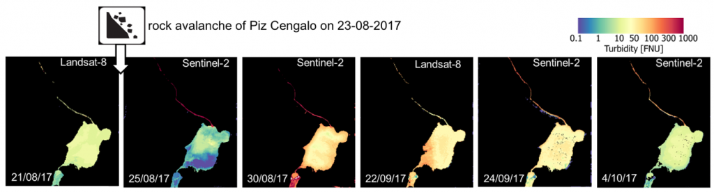
EOMORES in action: Rock avalanche in Pizzo Cengalo and consequent turbidity in Mera River and Lake Mezzola (Italy)
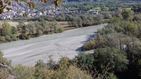
August 2017, a few million square meters of rock collapsed and slid down Piz Cengalo in Switzerland. The debris flowed downstream into the Mera River and into a dammed reservoir in Italy. To safeguard inhabitants from potential further landslides, the reservoir was totally emptied and all suspended sediments discharged into the Mera River. The sediment finally flowed into Lake Mezzola. This event has partially altered the lake’s ecology and affected the aquatic vegetation of the following season (2018) in this Natura 2000 site.
Satellite data were used to support field investigations assessing the flow of suspended solids between August and November 2017. The sequence of satellite products clearly shows the spatial distribution of suspend solids transported from the Mera River into Lake Mezzola.